geología

Coralis Del Mar Friedman Alvarez

Coralis del Mar Friedman-Álvarez es estudiante doctoral de Sismología en Cornell University, donde investiga terremotos en Alaska. Posee un bachillerato en Geología de la Universidad de Puerto Rico en Mayagüez. Coralis es arecibeña y disfruta viajar, la fotografía y el senderismo. Además, desea incorporar la comunicación científica en su trabajo.

Undefined

Geological Survey initiative seeks to create an updated seismic hazard map for Puerto Rico

This article is reproduced by CienciaPR with permission from the original source.

CienciaPR Contribution: 

No

The study began in February and has since been dedicated to conducting the first high-resolution airborne magnetic and radiometric surveys over the island and its surrounding waters.
A series of studies funded with more than $1 million in U.S. Geological Survey (USGS) funds will map the local geology and update Puerto Rico's seismic hazard map, which has not been updated in 20 years.

Tags: 

Students and alumni from the UPR published a new journal about Geography

This article is reproduced by CienciaPR with permission from the original source.

CienciaPR Contribution: 

No

By: 

Diálogo Digital

A group of students and alumni from the Univeristy of Puerto Rico published a new journal about Geography: Spatialties (Espacialidades).

The journal is available at:http://issuu.com/espacialidadescpg/docs/espacialidades_verano2015

To collaborate email: copugeo@gmail.com.

To read the full article, visit the Spanish version of this site. 

Tags: 

University of Puerto Rico excelled at NASA conference

Yaihara Fortis Santiago's picture

The study: Human Impact to Costal Ecosystems in Puerto Rico presented by a group of students from the University of Puerto Rico stand out from other 250 research projects at the Carbon Cycle and Ecosystems Conference organized by NASA.

This article was published in Diálogo Digital on May 7, 2015. To read the article visit:

http://dialogoupr.com/noticia/upr/la-upr-sobresale-en-la-nasa/ 

Passion for ocean and earth sciences

This article is reproduced by CienciaPR with permission from the original source.

CienciaPR Contribution: 

No

By: 

Gerardo E. Alvarado León / galvarado@elnuevodia.com

Christa G. von Hillebrandt, geologist, explains the importance to be prepared for an earthquake in Puerto Rico.

The original news story is in Spanish. To read the full text, please click on the "Español" button below or the link at the top right of the page.


Tags: 

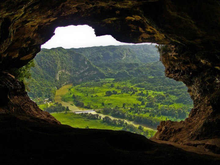
Las Cabachuelas, an underground treasure

This article is reproduced by CienciaPR with permission from the original source.

CienciaPR Contribution: 

No

By: 

Aurora Rivera Arguinzoni / arivera@elnuevodia.com

In 2012, Las Cabachuelas cave system was designated as a natural reserve. Unfortunately, the money destined to promote its conservation its being used for other purposes, putting this important ecosystem at risk.


The original version of this article in Spanish. You can access it by clicking on ESPAÑOL at the top right of your screen. You can also contact our editor Mónica I. Feliú-Mójer (moefeliu@cienciapr.org).

Tags: 

Cartilla del Agua en Puerto Rico - recurso de hidrología

Mónica Ivelisse Feliú-Mójer's picture

Nuestro amigo Pablo Llerandi Román nos hizo llegar el enlace para la Cartilla del Agua en Puerto Rico un excelente recurso sobre la hidrología y geohidrología de Puerto Rico. Puede ser útil para proyectos de investigación y enseñanza. ¡Compártanlo!

Rating: 

0

Forums: 

Tags: 

Poor urban planning evidenced once again

This article is reproduced by CienciaPR with permission from the original source.

CienciaPR Contribution: 

No

By: 

Gerardo E. Alvarado León /galvarado@elnuevodia.com

The recent landslide in Villa España, Bayamón, evidences, once again the unsustainable and poor urban planning policies in Puerto Rico. Experts agree that the geological risks of an area are often ignored to give way to construction.

The original version of this article is in Spanish. To see it click on ESPAÑOL at the top right of your screen. You can also contact our editor Mónica Feliú-Mójer (moefeliu@cienciapr.org).

Tags: 

Measure to protect our coasts

This article is reproduced by CienciaPR with permission from the original source.

CienciaPR Contribution: 

No

By: 

Aurelio Mercado-Irizarry / Oceanógrafo

The recent landslide in Bayamón, the publication of the long awaited Land Use Plan and the news that sea level rise has surpassed expectations underscore the need for a Coastal Construction Separation Line (CCSL) to protect Puerto Rico's coasts.

The original version of this article is in Spanish. You can see it by clicking on ESPAÑOL at the top right of your screen. You can also contact our editor Mónica Feliú Mójer (moefeliu@cienciapr.org).

Tags: 

The Science Behind Earthquakes

Mónica Ivelisse Feliú-Mójer's picture
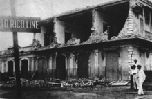
Earthquake in Puerto Rico
Ruins from Puerto Rico's earthquake in 1918.

Two months ago we received 2010 with the news that neighboring Haiti was struck with a 7.0 magnitude earthquake. Not recovered from Haiti’s situation, in the last days of February, Chile also experiences an earthquake; this time an 8.8 one and nowadays they are still getting aftershocks. After all these events have you ever asked yourself what causes an earthquake? Can Puerto Rico be struck by an earthquake? Fortunately, the answers to all these questions and the science behind earthquakes are the focus of the research of geologists like Dr. Daniel Laó Dávila and the Puerto Rico Seismic Network.

Subscribe to RSS - geología